Bringing The World Home To You

© 2024 WUNC North Carolina Public Radio
120 Friday Center Dr
Chapel Hill, NC 27517
919.445.9150 | 800.962.9862
91.5 Chapel Hill 88.9 Manteo 90.9 Rocky Mount 91.1 Welcome 91.9 Fayetteville 90.5 Buxton 94.1 Lumberton 99.9 Southern Pines 89.9 Chadbourn
Play Live Radio
Next Up:
0:00
0:00
0:00 0:00
Available On Air Stations

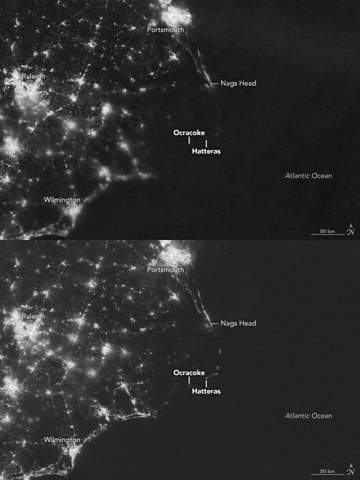
What Did The OBX Power Outage Look Like From Space?

NASA images captured the power outages along Ocracoke and Hatteras Islands last week.
NASA Earth Observatory
NASA images captured the power outage along Ocracoke and Hatteras Islands last week.

A NASA satellite captured nighttime images of two popular Outer Banks barrier islands that have been without power for nearly a week.

The images show Ocracoke and Hatteras Islands on July 27 and again on July 30, 2017, before and after the blackout.

The outage was caused when crews from PCL Construction building a new bridge over the Oregon Inlet severed the underground line Thursday. Generators have been brought in but can't produce enough electricity to support the estimated 50,000 visitors during a typical summer week.

Elizabeth “Liz” Baier is WUNC’s Supervising Editor for Race, Class and Communities. She has two decades of experience than span print, audio, and digital reporting and editing.
Related Stories
More Stories