With springtime comes the urge to get outdoors, and in a handful of North Carolina’s cities and towns, a growing network of greenways is making that easier to do. While North Carolina does not stand out nationally for its volume of bicycle commuters (it ranks 41st in the country), it does have a higher bike commuting rate than any neighboring state except Virginia. And several of North Carolina’s cities have adopted transportation plans to accommodate a higher volume pedestrians and cyclists.
This month, WUNC is taking a look at greenways and trails in the Triangle region and Greensboro. Do you have a favorite greenway in the area? Share it with us in the comment section below or on Facebook.
First stop: Greensboro
Many of Greensboro’s current bike/walk path projects kicked off in 2006, when the city adopted a plan recommending more than 400 miles of trails and greenways for the area. Since then, the City of Greensboro has teamed up with Guilford County Parks & Open Space Program and several local volunteers and organizations to build 7.3 miles of new greenways, 128 miles of sidewalks, and 11.2 miles of bicycle lanes. Although they’re a long way from the 400 miles promised in the plan, the trails completed so far are already seeing heavy traffic.
A & Y Greenway
One of the most heavily trafficked paths is the Atlantic & Yadkin (A & Y) Greenway, a 7.5 mile paved trail named after the abandoned railroad bed that it follows. It’s currently the city’s only paved Rail Trial, and runs roughly from Country Park, across Lake Brandt, to Bur-Mil Park, connecting a large swath of northern Greensboro. In Country Park, it also connects to the Bicentennial Greenway, a 14.5 mile paved trail that will eventually lead to High Point.
The A & Y railroad used to run between Mt. Airy and Sanford from 1899 to 1950. As more of the railroad bed becomes available, the city plans to extend the trail along it. Eventually, the Greenway will connect Summerfield, N.C. to downtown Greensboro.
Downtown Greenway

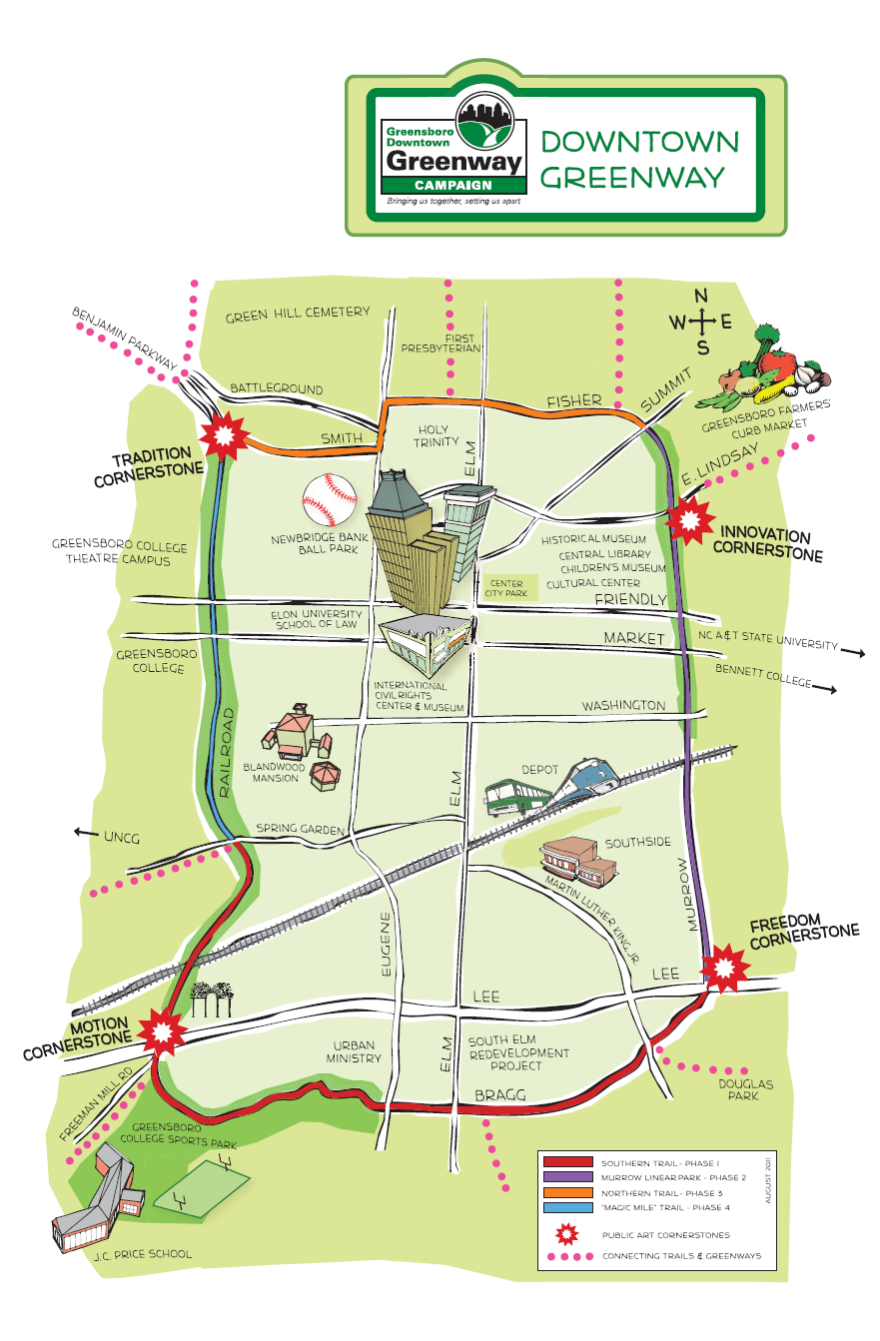
A greenway currently generating hype in the center of town is the Downtown Greenway, spearheaded by both the City and a nonprofit organization called Action Greensboro. Groundwork on this path began two years ago, and so far, two small portions of the proposed 4-mile loop around downtown Greensboro are complete, although it is still possible to bike or walk most of the loop on a detour route. The Greenway recently installed a landscaped buffer on a portion of the trail to treat stormwater runoff. Polluted runoff is channeled into the buffer and filtered by plants and soil before being reabsorbed into the groundwater.
One notable feature of the Downtown Greenway is that it doubles as a venue for public art. The city has commissioned artists to build benches, monuments, and bike racks along the path that reflect the feel of the community. So far, they have commissioned two benches and one of four major monuments. The slideshow above shows some of the artwork already in place, and the video below explains how artists were selected and went about their design process:
Blue Heron Trail
While Greensboro plans for many more miles of paved trails, the city has also completed a series of unpaved trials for mountain bikers and hikers. One of the newest is the 3.25 mile Blue Heron Trail, built in conjunction with the mountain bike group Greensboro Fat Tire Society. This trail follows the edge of Lake Townsend and has a variety of textured terrain – dips and deep gullies – specifically for mountain bikers. It takes its name from the birds that are often spotted along the lake.
Future plans for Greensboro's greenways include the completion of the Downtown Greenway, Blue Heron Trail, and A & Y Greenway. See a full list of Greensboro’s greenways here.


